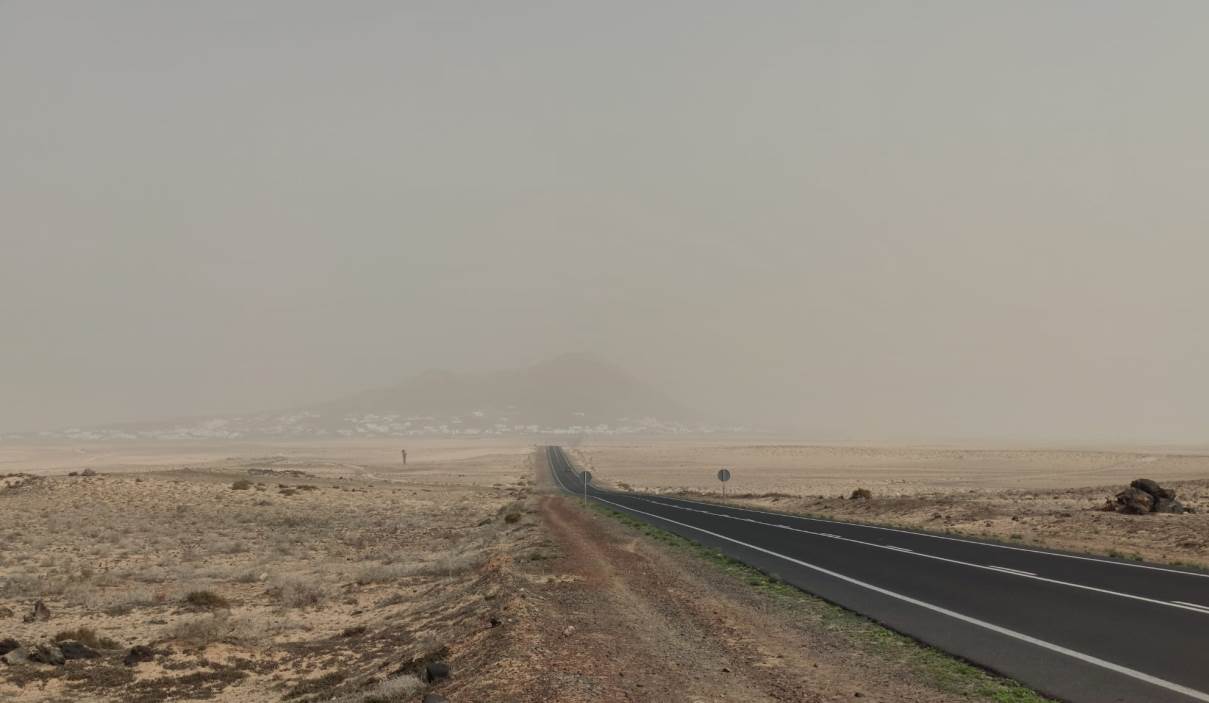
The drought situation that plagues the northern region of Africa, an atmospheric dynamic with intense winds that are capable of lifting dust, and the Azores anticyclone displaced further east than usual explain the abundance of haze episodes in the winters of the Canary Islands in recent years.
This was explained by the delegate of the State Meteorological Agency (Aemet) in the Canary Islands, David Suárez, in an interview with Efe in which he pointed out that since 2020 there has been an increase in the activity of suspended dust, the famous haze, towards the Archipelago.
This despite the fact that, according to the analysis of the series since the eighties, there is a downward line in the amount of haze that affects the Canary Islands, although there is "great variability" that means that at specific times there are peaks of intensity.
The authors who investigate this peak of haze since 2020 - some take it to 2011 - affirm that it is marked "by the meteorological situation behind it, by the environmental conditions in the source regions", in this case North Africa, which is the main source of suspended dust on the entire planet.
Why do these peaks occur?
In the first place, the peaks that have occurred in recent decades have coincided with prolonged periods of drought in North Africa, which causes the soil moisture to be lower and, therefore, the dust to be more available. This is combined with the existence of intense wind conditions.
"In other words, we need, first, for the dust to be available and, on the other hand, for the atmospheric dynamics to be capable of lifting that dust and transferring it to other regions, and that is what we have seen, for example, in these last winters," Suárez details.
These two elements are completed by another unforeseen circumstance. The Azores anticyclone, the one that sends the Trade Winds to the islands that temper their climate despite being in a subtropical region of the planet, is displaced further east than normal and has an unusually more intense activity than usual in this season of the year.
"Normally, in winter the anticyclone is usually more weakened and a little further south, but in these situations we have had it very well centered in southwestern Europe, with that flow of eastern component that causes all the dust to be dragged from the source region and transferred to the Canary Islands. And it has been a very persistent situation, of high stability," explains the meteorologist.
Why is the Azores anticyclone displaced?
In recent years, Suárez indicates, the "blocking pattern" in the anticyclone has predominated in the Canary Islands, so that the storms have run towards northern Europe. The normal thing is that the Azores anticyclone is more weakened than in summer and that it is further south.
This displacement can be explained by the La Niña phenomenon in the Pacific, which has predominated in the last three years, in conjunction with the aforementioned blocking pattern. A situation that seems to persist despite the fact that this year there is already a change in the situation of the largest ocean on the planet towards El Niño.
However, Suárez assures that it is "complex" to be able to determine the causes that motivate this displacement of the Azores anticyclone.
And it is that, despite the distance of the Pacific, a priori, with the North Atlantic and with the Canary Islands in particular, the truth is that the positive or negative cycle of El Niño or La Niña marks the world's meteorological conditions.
"It is true that they are teleconnection patterns, because what happens in a specific area of the planet has effects on the climate system", says the delegate of Aemet in the Canary Islands.
Can these variations be attributed to climate change?
Suárez admits that climate change may have an impact because the increase in temperatures and low rainfall contribute to lowering soil moisture and desertification of land north of Morocco.
However, he indicates that a correlation between the greater number of dust events and climate change cannot be seen, at least directly. And that there are no articles by researchers that conclude this.
"Surely there are many people, more specialized research groups, who may be doing this type of analysis, but I don't know today," the meteorologist acknowledges.
"I would point out the changes in land use that are taking place; the decrease in the relative humidity of the soil in the source region, if a decrease in rainfall is expected or if there has been a decrease in rainfall, and then we also have to see what synoptic patterns will dominate each quarter or each season," he lists.
Can these dust events affect new places?
In fact, Suárez insists, they are already affecting places that were not used to suffering from suspended dust. And it is also due to the Azores anticyclone.
"We see how those dust masses in winter are associated with that anticyclone, which ultimately what it does is move the dust very far north" of the continent, says David Suárez.
So much so that images have already been seen of regions of Scandinavia or the British Isles with the presence of African dust, and even snow covered by a thin reddish layer that shows that the haze could extend to unsuspected places.


