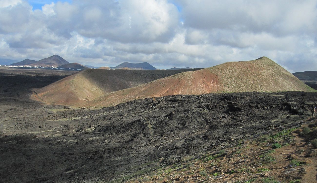
The routes and trails are a good way to get to know the island of Lanzarote, as on them you will discover secret beaches, volcanoes with a lot of history, and numerous breathtaking landscapes, all while being in full contact with nature.
Although Lanzarote has a large network of trails that extends throughout its geography, below are some of the most spectacular, although not suitable for everyone, as many require good physical condition.
1. Caldera Blanca and La Caldereta
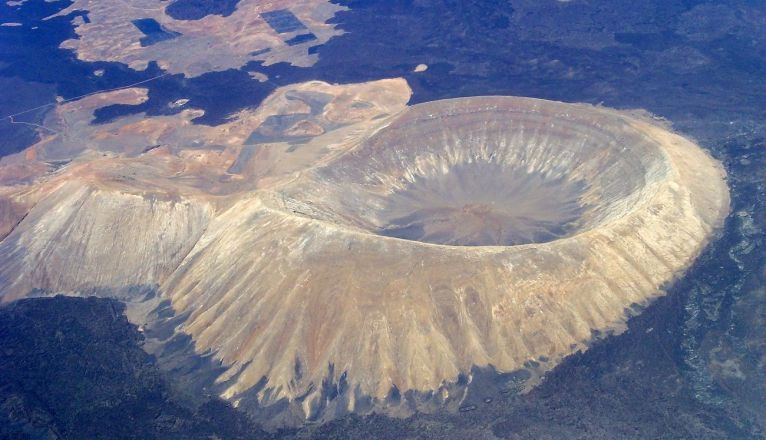
With more than 450 meters in height and a crater 1,200 meters in diameter, one of the most impressive volcanoes on the island is the Caldera Blanca volcano, located in the municipality of Tinajo.
The route to visit it consists of about 10 kilometers, and can be done in about four hours on average. The starting point is a parking lot on a dirt road called “camino del Cráter”, near the Hermitage of Los Dolores.
From there you will start a trail of just over 1 kilometer (about 25 minutes) in a zigzag through a solidified sea of lava, until you reach La Caldereta, another smaller volcano. Once you pass it, and follow the path, you will end up reaching the base of the famous Caldera.
The ascent does not pose much technical difficulty, and from the heights you can observe the contrast between the white of the volcano and the black of the lava sea, as well as its immense crater. Up to this point, it is a relatively simple route for which great physical condition is not required.
However, for those more adventurous who wish to see Timanfaya National Park, they can go around the crater on the left side until they reach the highest point of the volcano.
It is important to mention that one must be cautious during that part of the route, as strong winds can make the climb difficult, and it also requires a bit more physical stamina. Therefore, it is always recommended to climb when the weather is good and to ensure a firm footing, without rushing.
2. Camino de los Gracioseros
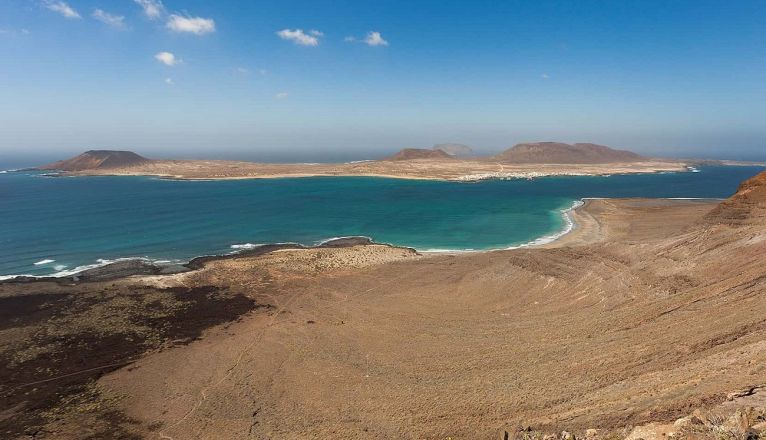
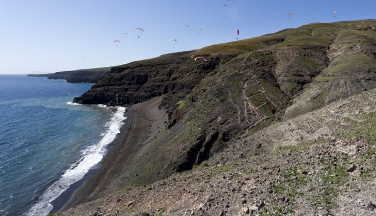
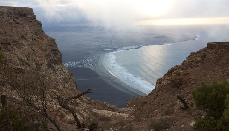
The Camino de los Gracioseros, better known as the “descent of the Risco”, is one of the most incredible routes in Lanzarote, as it consists of descending the Risco de Famara to reach one of the most solitary and quiet beaches on the island, Bajo el Risco beach.
It is important to mention that this is a route that can be dangerous in some sections, due to its slope and the poor condition of the path, full of stones, so it is recommended to proceed with caution.
To locate the descent point, you will have to go to the town of Ye and approach the Hotel Rural Finca La Corona. To the left, you will see a cobbled path where you can leave the car and begin the descent. It is a trail of about 45 minutes downhill with medium difficulty, due to its drop of more than 400 meters in height, so it is essential to do it with closed-toe and comfortable footwear.
Specifically, the greatest complication lies in the return journey, with it being normal to even exceed 60 minutes of travel during the ascent. Therefore, it is not recommended to go with small children or elderly people who are not in good physical shape.
Along the way, you can enjoy incredible views of the Chinijo Archipelago, especially of the island of La Graciosa. Once the descent is finished, you will reach a virgin beach of 500 meters of sand, with turquoise and generally calm waters, perfect for spending the day.
Remember to bring enough water and food during this route, as well as a fully charged mobile phone, since upon reaching the beach you will not find any type of service.
3. Ascent to Montaña Colorada
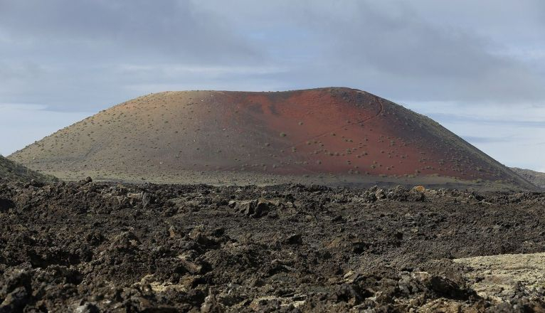
Opposite the Cuervo volcano, in Tinajo, lies Montaña Colorada, a volcano that owes its name to the reddish tones that characterize it, a consequence of the presence of iron oxides in the composition of the lava. It should be noted that this volcano was one of the last to form during the eruption period.
This circular route "to planet Mars" begins with a trail that ascends transversally. It is important to mention that it is a somewhat complex route, with a 465-meter drop, where the ground also tends to have the occasional loose stone, slowing down the ascent.
Therefore, it is recommended to climb with caution and at a slow pace, to ensure a good footing and avoid slipping. Once at the summit of Montaña Colorada, the ideal is to circle the crater, in order to observe incredible views towards the Timanfaya National Park and towards the Cuervo volcano itself.
To descend, you will have to go back the same way you ascended, then walk around the perimeter of the mountain and learn about its volcanic activity through the information panels.
4. Route from Femés to Playa Quemada
The route from the village of Femés to Playa Quemada, in the south, is a trail that offers at all times spectacular views of the Atlantic Ocean and the Los Ajaches Natural Monument, a 7.4-kilometer volcanic massif full of valleys and ravines.
It is a route of about 8.3 kilometers, about two hours approximately downhill towards the coast, and of medium difficulty, since although most of the time it is relatively easy thanks to the good condition of the path, the beginning is somewhat complicated.
The trail begins at the top of Pico del Filo, near the Church of Femés, with a narrow descent along a goat path, bordering the Barranco de la Higuera. After the first few kilometers, you will begin to see the sea with numerous marine cages in the distance, specifically a small black sand beach called El Pozo, with calm seas and in complete solitude, due to the difficulty of reaching it.
After resting for a while and refreshing yourself with a swim, the route continues along a path in a zigzag pattern along the cliffs that will take you to the famous black sand beach of La Arena, followed by the rocky beach of Playa Quemada, a final stretch that will take you about half an hour.
Once in Playa Quemada, you can take the opportunity to eat good fish or seafood in one of its three restaurants and put the final finishing touch to the route.
Being a linear trail, you will have two options to return to the starting point: either do the return route along the same path and cover another eight kilometers, or do the route with two cars, leaving one at the bottom in Playa Quemada and another in Femés.
5. Trail from the village of Teguise to Famara Beach
It is a circular route of about 22 kilometers of medium difficulty that crosses the Risco de Famara, in the north of the island.
The starting point is the urbanization of Los Noruegos, in Caleta de Famara, where you will find the marked trail. The first part, which runs along the Barranco de la Poceta, is quite easy and becomes more difficult as you ascend, although without the need for climbing or scrambling.
Along the route, you will be able to see cisterns and deposits or pools for water extraction that give the ravine its name. Once at the summit, you will find yourself at Las Peñas del Chache, the highest point in Lanzarote, at over 600 meters high.
After skirting the Risco by the Las Nieves viewpoint, you will reach the Hermitage of Las Nieves, where you can take a break, and then continue to Pico de Marmajo. This part is very easy, as it is the path that many residents of Teguise take to reach this small church.
Upon reaching the Peak, a somewhat more complicated descent begins due to the small loose stones on the path, passing through Lomo de La Casa, Morro Alto, and Las Laderas, until reaching Los Noruegos, the starting point,
Due to the difficulty of the trail and its duration, of about four and a half hours, it is not recommended to do it alone or if you are not in good physical shape.

Add La Voz de Lanzarote as a preferred Google source.
Stay informed with the latest current news.