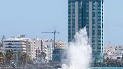
The Government of the Canary Islands, through the Directorate General of Emergencies, has declared a state of pre-alert for coastal phenomena in El Hierro, Tenerife, Gran Canaria, Lanzarote, and La Graciosa, starting at 00:00 on Monday, July 20.
According to the Directorate General of Emergencies, "this decision is made taking into account the information provided by the State Meteorological Agency and other available sources, and in application of the Specific Plan of Emergencies of the Canary Islands for Risks of Adverse Meteorological Phenomena (PEFMA)".
The wind will blow strongly from the northeast in the inter-island maritime channels, reaching 50 to 61 km/h (force 7) south of the channel between Tenerife and Gran Canaria, and offshore in the southeast of Gran Canaria.
Combined sea waves of up to 3.25 m on the northeast coasts of El Hierro, which will be above 2 m on the rest of the north and east coast of this island. In Tenerife and Gran Canaria, waves that could reach and exceed 2.5 m on the southeast coast of Tenerife, as well as on the west coast of Gran Canaria.
On the northeast coasts of Lanzarote and La Graciosa, waves between 2 and 2.5 m. Isolated waves of up to double this significant height can be expected.
Add La Voz de Lanzarote as a preferred Google source.
Stay informed with the latest current news.