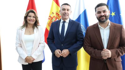
The Plenary of the Cabildo of Lanzarote and La Graciosa has approved the Project for the Natural Resources Management Plan (PORN) of the Los Volcanes Natural Park. The Governing group of the first island institution, made up of Coalición Canaria, the Partido Popular, and a councilor from the Mixed Group, argues that the approval of this instrument is "a historic milestone" for Lanzarote.
This is the first major territorial and environmental management document initiated, processed, and completed during the current term. Its approval will allow the full legal effectiveness of this protected area to be restored, providing legal certainty to both public administrations and citizens.
The president of the Cabildo of Lanzarote, Oswaldo Betancort, highlighted that “this is one of the most important agreements adopted by this corporation in recent years because it shows that Lanzarote can move forward when there is political will to unblock the island's strategic issues”.
“For too long, territorial planning remained paralyzed, generating uncertainty for residents, farmers, businesses, and administrations. Today we take a decisive step to reverse that situation and demonstrate that it is possible to protect our territory while responding to the real needs of the population,” added Betancort.
The vice-president of the Cabildo of Lanzarote, María Jesús Tovar, assured that this approval “represents a step forward in planning for Lanzarote”. “With coordination, the areas of Territorial Policy and the oversight team of the Treasury and Contracting area have achieved a fundamental document for the residents of the south of the island. A security and peace of mind that is more than necessary in one of the most beautiful areas of our island,” she added.
"A historic advance for El Golfo and for the municipality of Yaiza," according to the Cabildo
Among the measures, the Cabildo highlights the recognition of El Golfo as a consolidated urban center within territorial planning. This is a "historic demand" from the residents of this coastal town in the municipality of Yaiza, who "for decades have lived with a situation of legal uncertainty regarding their homes".
Thanks to this recognition, "numerous owners will be able to advance in the procedures to legally register their properties and regularize their situation in accordance with current regulations, putting an end to a problem that had been dragging on for decades.
“We are talking about families who had been waiting for a solution for many years. This Government has had the courage to face a historical problem and offer a response that brings tranquility, stability, and legal certainty to the residents of El Golfo,” stated the insular president.
The document also includes strategic modifications in the municipality of Yaiza to facilitate the development of essential public facilities. Specifically, it incorporates changes that will allow for adequate land for future actions related to the expansion of the health center, the improvement of municipal sports facilities, and other necessary public services to meet the population growth of the area.
From natural protection rustic land to rural settlement rustic land
Likewise, the Plan modifies the classification of certain lands, which change from natural protection rustic land to rural settlement rustic land, allowing for orderly development compatible with environmental conservation based on the areas already consolidated along the road.
The Minister of Territorial Planning and Territorial Policy, Jesús Machín, highlighted that “this document symbolizes the change of direction that territorial policy in Lanzarote has undergone after years of neglect and legal limbo.”
“We have recovered files that had been forgotten for years,” added Machín, “and we have complied with all legal procedures, managing to move forward not only with the Natural Resources Management Plan of the Volcanoes Natural Park, but also with the scope document of the Insular Planning Plan of Lanzarote and the Chinijo Archipelago - PIOLC; the Advance of the Special Plan for the Protected Landscape of La Geria and the Management and Use Plan of the Chinijo Archipelago Natural Park,” the minister insisted.
A participatory and guaranteeing process
The processing of the PORN began with the draft being taken into consideration by the Governing Council in June 2024. Subsequently, the document was subjected to a public information and consultation process with the affected administrations, being published in the Official Gazette of the Canary Islands, in the Official Gazette of the Province, and on the Cabildo's website.
During this period, reports were received from different bodies and a total of five objections, all of which were analyzed and answered by the drafting team, incorporating those contributions considered compatible with the conservation and management objectives of the space.
Likewise, before being submitted for approval, the final proposal was submitted for consultation to state bodies such as the Directorate General of Coasts and the Sea and the Ministry of Defense, whose favorable reports allowed the final drafting of the document to be completed.
Jesús Machín highlighted "the enormous technical, legal, and administrative effort made during these years to move forward a complex document that has overcome all the procedures required by the regulations and that has had the utmost guarantees of participation, transparency, and legal certainty".
A roadmap for the conservation and balanced development of the territory
The Los Volcanes Natural Park covers an area of more than 10,158 hectares spread across the municipalities of Tinajo, Yaiza, and Tías. It surrounds a large part of the Timanfaya National Park and also borders the La Geria Protected Landscape and the Salinas del Janubio Site of Scientific Interest, forming one of the most unique landscape and ecological complexes in the Canary Islands.
Furthermore, this area coincides with areas integrated into Red Natura 2000, such as the La Geria Special Protection Area for Birds (ZEPA) and the Los Volcanes Special Conservation Area (ZEC).
The approved document establishes criteria for the conservation of the habitats and species present in the protected area, regulates uses compatible with its environmental values, incorporates specific measures for adaptation and mitigation of climate change, and reinforces the ecological connectivity of the territory.
Among other actions, it contemplates the promotion of environmental monitoring programs, scientific research on the effects of climate change, measures to increase the resilience of ecosystems, and guiding criteria for future sectoral policies affecting the Park's scope. Likewise, the technical and legal reports issued by the Cabildo conclude that the document fully complies with state and regional legislation on natural heritage, biodiversity, and territorial planning.
With this approval, the Cabildo de Lanzarote asserts that it "takes a decisive step to recover the island's planning capacity, resolve historical problems affecting citizens, and consolidate a new territorial management model based on legal certainty, environmental protection, and effective response to the needs of the people of Lanzarote".



Add La Voz de Lanzarote as a preferred Google source.
Stay informed with the latest current news.