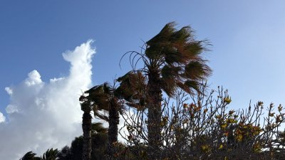
The Directorate General of Emergencies has declared a pre-alert situation due to wind in all the islands, starting at 5:00 PM this Saturday, September 5.
Emergencies explains that "this decision is made taking into account the information provided by the State Meteorological Agency and other available sources, and in application of the Specific Emergency Plan of the Canary Islands for Risks of Adverse Meteorological Phenomena (PEFMA)".
Areas exposed to the trade winds of El Hierro, La Palma, La Gomera, Tenerife, and Gran Canaria, especially peaks and east, southeast, west, and northwest slopes according to the orography of each island; as well as interior and southern coastal areas of Lanzarote, southern Jandía, and interior areas of Fuerteventura.
Intensification of the trade winds, with moderate to strong winds in exposed areas and the possibility of locally very strong gusts, especially during Sunday.
The greatest accelerations will occur due to orographic effects in specific areas of the islands, highlighting the interior and southern coast of Lanzarote, southern Jandía in Fuerteventura, the east and west slopes of Gran Canaria, the northwest and southern tip of Anaga in Tenerife, the east and northwest slopes of La Gomera, the southeast and northwest tips of La Palma, and the peaks and southeast and west slopes of El Hierro.
Likewise, the presence of medium convective cloudiness may generate locally very strong gusts of variable direction in high areas.
The episode will be irregular and localized, largely conditioned by the orography. Its evolution and successive updates of the meteorological forecast will be monitored.
Add La Voz de Lanzarote as a preferred Google source.
Stay informed with the latest current news.