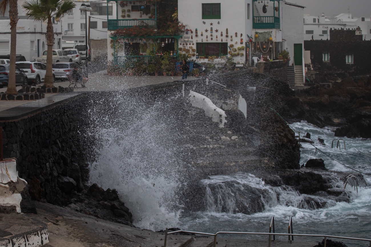
The worsening of the sea state expected from this Thursday afternoon has forced the Government of the Canary Islands to declare a situation of alert for coastal phenomena in the islands of Lanzarote and Fuerteventura, while maintaining the pre-alert in the rest of the archipelago.
This decision has been taken based on the information provided by the State Meteorological Agency and other available sources, and in application of the Specific Emergency Plan of the Canary Islands for Risks of Adverse Meteorological Phenomena (PEFMA).
According to the Adverse Phenomena Bulletin published this Thursday morning, the island will be on orange alert from 6:00 p.m. this Thursday afternoon until 00:00 a.m. The probability that the combined sea from the north will bring waves of between five and six meters in this period is between 40 and 70%.
The alert, which will come into effect from 6:00 p.m., will mainly affect the north and west coast of Lanzarote and Fuerteventura, where combined sea waves are expected to reach and/or exceed five or six meters in height throughout this Thursday, as well as strong swell with areas of rough seas, and northwest swell of three to four meters in these islands.
In the rest of the coastline affected by the pre-alert of coastal phenomena, that is, the north coast of Tenerife and Gran Canaria, and the north and west coast of La Palma, El Hierro and La Gomera, the waves could reach 3 or 4 meters in height and the wind is expected from the northeast force 5 to 6, that is between 39 and 49 km/h with large areas of force 7, between 50 and 61 km/h, and occasionally force 8 with 62 to 74 km/h in the high seas.
During tomorrow Friday, the forecast includes combined sea waves that will probably reach and/or exceed 4 or 5 meters on the north and west coast of Lanzarote and Fuerteventura and between 3 and 4 meters on the rest of the coastline affected by the pre-alert situation. On the other hand, wind is expected from the northeast force 5 to 6 (29 - 49 km/h) with large areas of force 7 (50 - 61 km/h); rough seas in Lanzarote and Fuerteventura, strong swell to rough seas in the rest of the archipelago and northwest swell of 2.5 to 4 meters.
Likewise, special attention should be paid to the spring tides and take into account the times of high tides which will be at 01:55 - 02:35 hours and at 14:20 - 15:05 hours.
Given this situation, the Government of the Canary Islands recommends that the population take extreme precautions on the coasts of the islands and insists on the importance of putting self-protection advice into practice to avoid risks on the coast.
In that sense, it is advisable to postpone nautical or sports activities until the situation improves; avoid fishing in dangerous places since a sudden change in the sea can drag us out to sea and, if you have a boat, secure its mooring in a sheltered place.
During high tide, avoid areas where you can become isolated; keep in mind that during spring tides the currents are stronger and always stay away from docks and breakwaters even if the sea suddenly calms down, as well as avoid walking or circulating through areas near the beach line.
Recommendations to the population
-
Protect your home from the possible invasion of sea water.
-
Do not stand at the end of docks or breakwaters, or risk taking photos or videos near where the waves break.
-
Avoid fishing in risk areas.
-
Do not drive with a vehicle on roads near the beach line.
-
Never swim on secluded beaches or that you do not know well enough, because there may be local eddies.
-
Avoid swimming on beaches with a red flag, in areas where there is strong waves and undertow or that lack surveillance and rescue services.
-
Avoid practicing sports and nautical activities in the areas affected by the swell and do not camp on the beach when there is an alert for sea storm.
-
If you notice some abnormal waves, do not stay near the sea, or approach, even if it calms down suddenly.
-
If you have a boat, try to secure its mooring in a sheltered place.
-
If you see other people in dangerous places, warn them of the danger.
-
If you fall into the water, move away from where the waves break, ask for help and wait to be rescued.
-
If you try to get out and are dragged by the waves, try to calm down; do not swim against the current and let yourself be carried away. In general, coastal currents lose intensity in other sections and it is then when you should swim.
-
If you are on land and see that someone has fallen into the water, throw them a rope with a float, or any other object they can hold on to. Immediately notify 1-1-2.
