The maximum alert situation in the Canary Islands since Saturday due to the tropical storm Hermine has ended at 12:00 noon this Monday, which will allow normality to return to the classrooms on Tuesday, as announced at a press conference by the regional president, Ángel Víctor Torres.
However, all the islands will remain on alert this afternoon, except for Lanzarote and Fuerteventura, where there will only be a pre-alert, as the situation there is better.
In the last few hours, the most significant water discharges have been recorded in La Palma and in the south of Gran Canaria, with more than 30 liters per square meter in one hour, which caused the Red Cross to temporarily evacuate a group of about 50 people from their homes, Torres and the head of Civil Protection and Emergencies Marta Moreno have reported.
The Canary Islands president has stressed that this is a "historic" meteorological phenomenon due to the rainfall recorded in the islands in a month of September, which has exceeded 300 liters per square meter in La Palma, and that the greatest incidents suffered have been due to power cuts, which in the early hours of this Thursday still affected 400 subscribers, out of the 2,000 who have suffered them since the beginning of the maximum alert, and due to cancellations and diversions at airports, since the ports have operated normally.
According to Torres, 70 flights have been canceled this Monday and there have been diversions, but from 11:00 am it was planned that normality will be restored at the Canary Islands airports, where on Sunday the cancellations affected about 50 percent of the operations.
The most affected municipalities
The most significant damage caused by the rains has occurred in the municipalities of La Aldea, in Gran Canaria, and in Candelaria and Güímar, in Tenerife, although the different administrations will assess the incidents recorded in all the islands.
After the passage of the tropical storm turned into a subtropical storm, this Tuesday educational normality will be restored, with the return to the classrooms, as well as work, since teleworking was recommended to avoid travel.
Torres has emphasized that the work carried out preventively has been fundamental, for example, with the removal of vehicles from the ravines, and above all that there have been no personal injuries.
The delegate of the State Meteorological Agency for the Canary Islands, David Suárez, stressed that this has been an episode of "extraordinary" rainfall due to the approach of a tropical cyclone to the islands, and that the yellow warnings for rain will continue until the early hours of Tuesday morning.
The archipelago will then recover its normal weather, as it will be under the influence of an anticyclone from the north of the Azores and with northeast flow, Suárez said.
Regarding the meteorological episode that has affected the islands these days, the representative of Aemet considered that it will be "an important case study".
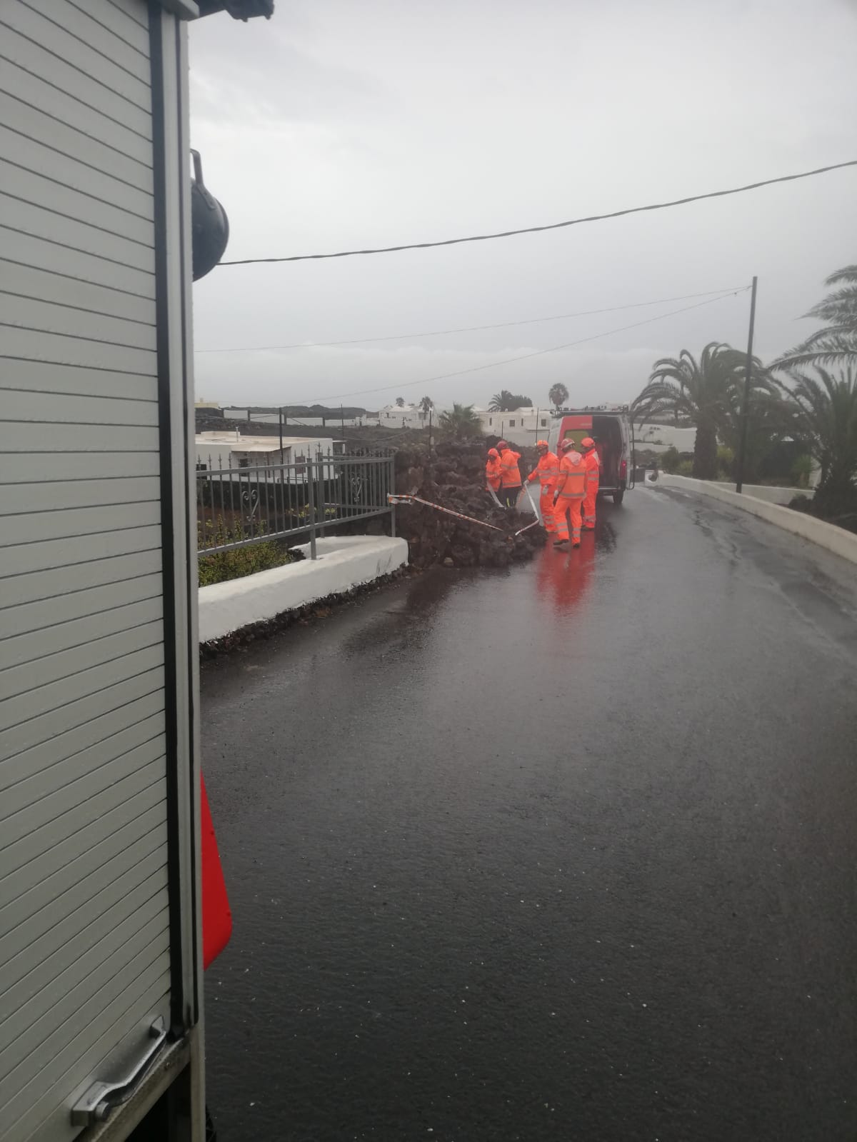
Road closures continue on several islands
The head of Civil Protection, Marta Moreno, pointed out that the island of La Palma has been the one that has presented the most complications last night, with flooded houses and different incidents, after this Sunday it was the municipality of La Aldea, in Gran Canaria, where the situation has stabilized and work is being done on the damage caused.
In any case, Ángel Víctor Torres has pointed out that in La Palma the rain has fallen on the east side of the island, so there have been no runoffs that were feared to have occurred in the west side, the one affected by the volcano.
Moreno has pointed out that numerous roads remain closed on the islands, except in Lanzarote and Fuerteventura, and that they will be opened gradually, although he has warned that the risks of landslides may persist in the coming days, so he has asked for caution when driving.
Torres has insisted on thanking the administrative coordination between the councils and security forces, as well as the exemplary behavior of the population, and the willingness of the Government of Spain, which offered troops from the Military Emergency Unit (UME) and even moved reinforcements to the islands in case they were needed.
The head of Aemet in the Canary Islands has warned of the tendency for tropical storms to form in the islands, such as this one that originated near the coast of Cape Verde, although the normal thing is that they originate in the Caribbean, he said.
Add La Voz de Lanzarote as a preferred Google source.
Stay informed with the latest current news.