The Ministry of Ecological Transition and Energy of the Government of the Canary Islands, led by Mariano H. Zapata, has carried out a measurement campaign on the maritime front from La Bufona to the Islote del Francés, and the coastal stretch of Las Caletas, in the municipality of Arrecife.
The objective is to understand the depth, the underwater relief, and the composition of the seabed, in order to plan adaptation measures in the face of rising sea levels and coastal erosion. The budget to analyze these six areas throughout the Canary Islands amounts to 111,300 euros, while the project that includes it, ADAPTACOST6, has a total investment of 2,317,300 euros.
The Councillor for Ecological Transition and Energy, Mariano Zapata, stressed that "Arrecife is one of the main enclaves that could suffer the effects of climate change in the Archipelago, given that in this section of the city's seafront, both the high-value urban and economic fabric and the recreational public spaces—promenades and beaches—, and the infrastructures and facilities, as well as a notable set of historical and cultural heritage assets, would be compromised."
In this regard, he emphasized that "the Ministry is working on these studies to have high-precision scientific information that allows us to anticipate risks and design clear and effective adaptation solutions that guarantee the safety of the population and essential services in the coming decades."
Zapata also noted that, with the data obtained, "high-resolution climate scenarios will be developed for the year 2050, which will allow simulating different flood and erosion situations, which constitutes the basis for prioritizing and sizing adaptation measures within the coastal resilience strategy of the Canary Islands." One of the main objectives, explained the councilor, "is to have scientific data that helps us protect the population from those effects that may occur."
```html
```
For his part, the mayor of Arrecife, Yonathan de León, highlighted that knowing "these future forecasts will allow us to better plan actions on the city's seafront. We were born as a coastal city, and we know that there are important challenges in being a municipality born at the natural mouth of the ravines on the northern periphery of Arrecife, next to San Bartolomé and Teguise, with the nerve center of the island's capital a few meters from the tide, at the same level as the sea." Levels that, he explained, "will rise in the second half of this 21st century."
The work carried out on the coast of Lanzarote has made it possible to develop a submarine cartography of three zones: the Charco de San Ginés, with an area of 6.27 hectares; the eastern zone, from the south to the port's breakwater, with 200.63 hectares; and the western zone, from the breakwater to the north, with 301.36 hectares. In addition, sediment samples were taken to analyze the texture and characteristics of the seabed.
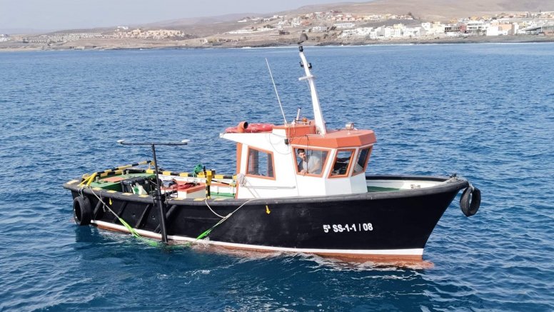
The work has been carried out by the company ECOS, Estudios Ambientales y Oceanografía S.L., contracted by TRAGSATEC, the entity responsible for coordinating the ADAPTACOST6 project. The field campaigns were conducted between June and August 2025, using a multibeam echosounder, inertial navigation, and motion compensation techniques to ensure the accuracy of the results.
The Arrecife study is part of the ADAPTACOST6 project, which includes a total of six areas of the Canary Island coastline on the islands of Fuerteventura, La Palma, La Gomera, Tenerife, Gran Canaria, and Lanzarote.
Add La Voz de Lanzarote as a preferred Google source.
Stay informed with the latest current news.