The Island Hydrological Plan, which was released for public display last July, paints a worrying picture of the evolution of Lanzarote in recent decades, in all aspects related to water and the environment. In the diagnosis of the current situation, the document speaks of "contamination" in groundwater and on the coast; of risk situations in the face of adverse weather phenomena due to urban excesses; of a system of drinking water production with excessive costs and plagued with deficiencies; and of a great lack of knowledge about the real situation of the island's water resources, since studies and monitoring of the situation have not been carried out.
In the summary of the diagnosis, the Plan warns, among other things, that "the low level of collection and treatment of wastewater, and the inappropriate use of fertilizers in agriculture are causing contamination of groundwater and coastal surface water". In addition, it highlights that "urban development and agricultural activity are affecting the natural environment (such as ravines, rural areas, forest mass or the coastline), and the species and habitats associated with it".
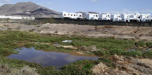
These environmental damages are also added to the risks that have been created with certain urban interventions. "The occupation of the Public Domain (channels and coastline), the non-compliance with regulations and the lack of surveillance and sanctioning means are leading to the creation of risk situations", the document underlines. In this regard, it adds that this has produced "significant morphological alterations and effects on environmental conditions", harming the habitats and species linked to the channels, but also generating flood risks, as is evident with any rain of a certain intensity.
Discharges that "degrade" the quality of coastal water
With respect to coastal water, the document speaks of "degradation" of its quality due to "different discharges". In this regard, it points out that "both brine discharges", from desalination plants, "and wastewater discharges with insufficient treatment or without the appropriate outfall, can cause effects on coastal water bodies and loss of priority habitats".
According to the document, "these effects will have a significant impact on fishery and shellfish resources, as the physical-chemical and/or biological degradation of these water bodies will lead to a decrease in species diversity and fish production". A situation that does not affect most of the island's coastline, but does affect the points subjected to this type of discharge.
However, once again, the document warns of the lack of studies in this regard "to determine the impacts produced by these sources of pollution, since no type of measures has been taken in this regard" and "it cannot be determined whether there is any water body at risk from diffuse sources of pressure". "As there is also no monitoring network for the ecological status of coastal waters", the report adds, "there is also no verified information on the impacts that are being produced on them, although it is known that these activities produce this type of impact".
In addition, it also concludes that "the urban pressure and that of other activities (industrial, port, facilities, etc.) on the coastline is causing significant morphological alterations on it, and effects on its environmental conditions".
No control of groundwater
Regarding groundwater, it also underlines the lack of knowledge about its current state and points out that "a control network must be defined on which to articulate the monitoring programs of the chemical state, both the surveillance and operational control, and monitoring of the quantitative state".
The Hydrological Plan details that currently there is only one control point for groundwater bodies on the island, "which is sampled once a year", and recommends creating at least two more, one in the Haría area and another in the central area (Tinajo, Mozaga, La Asomada, San Bartolomé).
In addition, it considers that some sounding should be carried out in the area of the Zonzamas Environmental Complex, "to assess its possible impact on the quality of groundwater bodies".
In the same line, it considers that it would be desirable to control the groundwater in the nuclei of Tahiche, Villa de Teguise, Tías, El Calvario, Montaña Roja and Playa Blanca, since "from the information contained in the Survey of Local Infrastructure and Equipment (EIEL) of the year 2000, it is deduced that they may be potentially polluting".
Water supply outside the "health regulations"
Regarding the water that is distributed for consumption, the Plan's diagnosis refers to well-known aspects, such as "the insufficiency and obsolescence of the transport and regulation infrastructure", which generates significant water losses in the network. But it also adds that "there are designs, materials and state of the supply infrastructures that do not comply with current health regulations and that do not guarantee the supply".
Regarding this issue, it also questions that "users are not properly informed about the quality of the water". In addition, it warns that "the losses and the lack of quantitative and qualitative control, in addition to the consideration of environmental costs, are not allowing a full application of the principle of water cost recovery"; and that "the lack of efficiency and state of the infrastructures, as well as awareness about water saving, is leading to a level of significant resource losses".
To solve all the problems detected, the Hydrological Plan proposes three possible alternatives in each case, minimum, maximum and intermediate, and ends up opting for the latter as it is the most realistic. "The intermediate alternative achieves the same objectives as the maximum alternative, although with a greater delay in time, but more in line with the efforts and resources that can be available", the document argues.
And one of the problems that it raises and that has generated the current situation is the "limited public financing capacity to carry out the infrastructures that are needed", as well as the "limited coordination between the administrations and the planning for the development of the necessary infrastructures" and the "lack of agility of the Administration and of the hydrological planning".