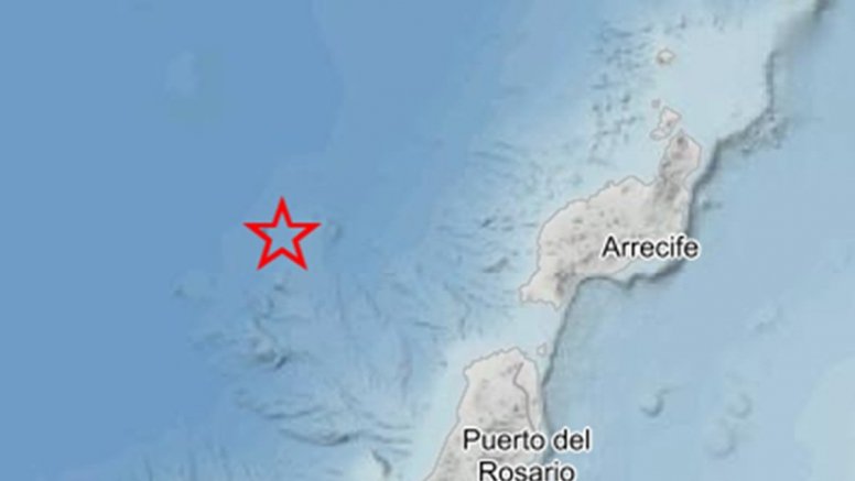
The National Geographic Institute (IGN) recorded an earthquake with a magnitude of 2.2 at approximately 9:30 p.m. this Sunday near the coast of Lanzarote.
Specifically, the earthquake occurred at a depth of 30 kilometers and was located at 28.5 degrees north and 14.2 degrees west of the island. Due to the depth at which it was recorded, it was not felt by the population.
Back in May of this year, another earthquake was recorded in this same area, measuring 2.5 on the Richter scale and occurring at a depth of 6 kilometers.
In addition, in recent weeks other parts of the archipelago have recorded a large number of earthquakes, some of them felt by the population. The latest, measuring 3.4 on the Richter scale, occurred in the early hours of Sunday between Gran Canaria and Tenerife in the area known as the Enmedio volcano.
Likewise, the island of Tenerife has been recording several seismic series with small earthquakes of low intensity in the central zone, right at the foot of El Teide. However, the National Geographic Institute points out that this is a totally normal process in a volcanic archipelago and there is no cause for alarm.
However, the IGN is closely monitoring these earthquakes in case these episodes escalate.